Report time: Approximately 18:00 UTC / 13:00 Colombia time
Status: Developing; seismic parameters, casualty figures and damage assessments may be revised.
Executive summary
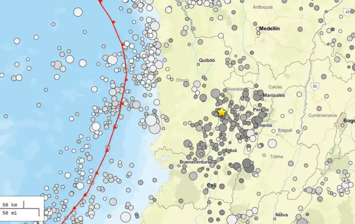
A major earthquake struck western Colombia at 07:34:29 local time on Monday, 10 August 2026—12:34:29 UTC—with its epicentral area near San José del Palmar in the department of Chocó. The Colombian Geological Service, or SGC, currently lists a magnitude of 7.4 and a depth of 96 kilometers (link). The US Geological Survey independently gives a reviewed magnitude of 7.4 Mww, a depth of 107 kilometers, and a location approximately five kilometers east of San José del Palmar.
Severe damage has been reported in parts of western and central Colombia, particularly around Pereira and Risaralda, Cali and Valle del Cauca, Manizales, Quibdó and Buenaventura. Reuters’ latest available update reported at least 111 deaths, while other major outlets were carrying lower totals at different update times. A cautious preliminary description is therefore at least 70 fatalities, pending a single consolidated government count (Reuters). Rescue operations were continuing at collapsed or seriously damaged structures, and operations were temporarily suspended at several regional airports for inspections.
Colombia’s maritime authority, DIMAR, determined that the earthquake did not have the characteristics necessary to generate a tsunami on the Colombian Pacific coast and said that no further tsunami action was required.
Seismological assessment
Origin and location. The mainshock occurred at 12:34 UTC, close to San José del Palmar. The small differences between the SGC and USGS epicentral locations and depths reflect the use of separate station networks, velocity models and processing methods. Both agencies nevertheless agree that this was a magnitude-7.4, intermediate-depth earthquake.
Depth and source. A hypocentral depth of approximately 96–107 kilometers places the earthquake in the intermediate-depth category rather than among shallow crustal earthquakes. USGS regional information describes this part of Colombia as an area where the Nazca Plate descends beneath South America and where earthquakes occur inside the subducted slab at depths of roughly 70–300 kilometers. The present depth and location are therefore consistent with a rupture within the descending Nazca slab, although a final focal-mechanism or moment-tensor solution is needed to determine the exact style and orientation of faulting.
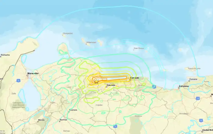
The intermediate depth probably contributed to the unusually broad felt area: shaking was reported across much of Colombia and in parts of Ecuador, Panama and western Venezuela. Depth can spread seismic energy over a wide region, but it does not prevent serious damage from an earthquake of this magnitude, particularly where buildings are vulnerable or local ground conditions amplify motion.
Aftershocks. Several smaller earthquakes occurred soon after the mainshock. The SGC recorded a magnitude-4.8 event at 08:18 local time, at a depth of 88 kilometers near San José del Palmar, followed by additional smaller events. Aftershock locations and magnitudes may continue to be adjusted as analysts review the sequence.
Tsunami assessment. DIMAR’s National Tsunami Warning Centre used the SGC parameters—magnitude 7.4 and depth 96 kilometers—and concluded that the inland, relatively deep earthquake lacked the characteristics required to produce a tsunami affecting Colombia’s Pacific coast.
Preliminary impacts
The most serious early reports came from the western departments and the Coffee Region. Reuters reported that Risaralda had the largest identified share of fatalities, while buildings were damaged or collapsed in Pereira, Cali, Manizales, Quibdó and Buenaventura. People remained trapped at several locations in Cali, and emergency teams were requested from Bogotá and Medellín.
Air transport was also disrupted. Flights were suspended at airports serving Pereira, Manizales, Quibdó, Armenia, Cartago and Buenaventura while engineers checked terminals and other infrastructure. Reports from Pereira showed significant damage at Matecaña International Airport.
The national response included emergency coordination among central and territorial authorities, deployment or preparation of specialist rescue personnel, structural inspections and searches of collapsed buildings. Because communications, access and reporting from affected municipalities remain uneven, the current totals for fatalities, injuries and damaged homes should not yet be treated as final.
Principal uncertainties to monitor
The next assessments should clarify the consolidated casualty and injury totals; the number of collapsed, unsafe or uninhabitable buildings; the condition of hospitals, roads, bridges, airports and utilities; and whether landslides have isolated rural communities.
On the scientific side, important forthcoming information includes the final hypocentre, moment-tensor solution, maximum observed shaking intensity, USGS ShakeMap and PAGER revisions, and the spatial development of the aftershock sequence. Aftershocks are expected following a mainshock of this size, but their exact timing and magnitude cannot be predicted.
Seismological and official links
Servicio Geológico Colombiano — mainshock event page: magnitude, depth, origin time and event identification.
SGC live earthquake viewer: continuously updated Colombian seismic catalogue.
SGC “Sismo Sentido” portal: official public felt and effects reporting form.
USGS event page: reviewed earthquake parameters and access to ShakeMap, impact and felt-report products.
USGS regional tectonic information: subduction and intermediate-depth seismicity around western Colombia.
DIMAR tsunami bulletin: official determination that there was no tsunami threat to Colombia’s Pacific coast.
News links
Reuters: latest wire-service casualty, damage, rescue and airport information.
Associated Press: field reporting from affected cities and information from regional officials.
The Guardian: latest news
El Espectador: Spanish-language explanation of the SGC magnitude revision and early aftershock sequence.
Caracol Radio: local reporting on affected departments and emergency coordination.
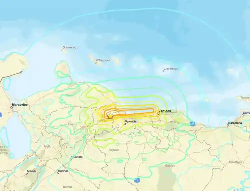
Map image by earthquake.usgs.gov